
")


")
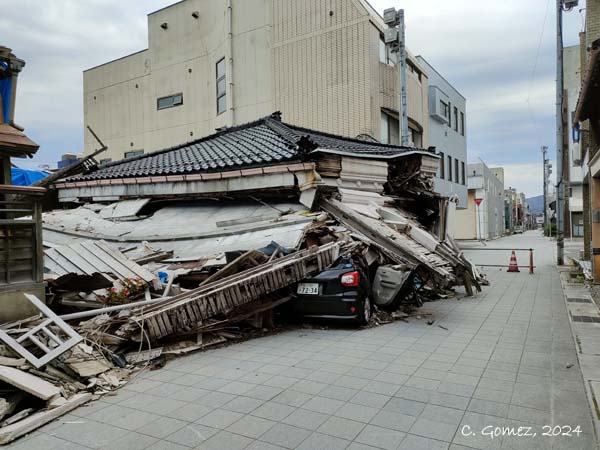
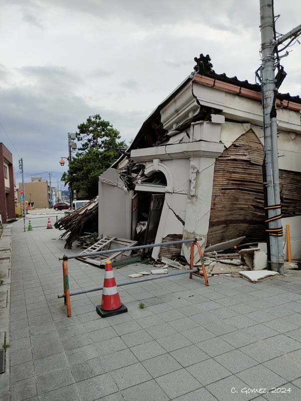
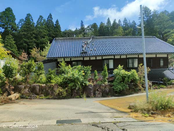
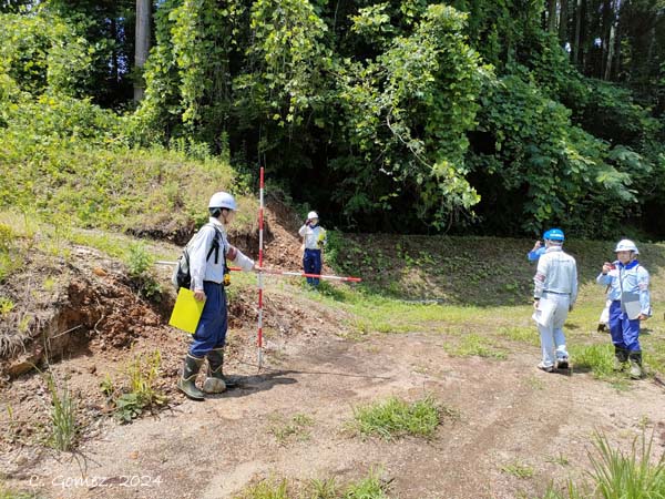
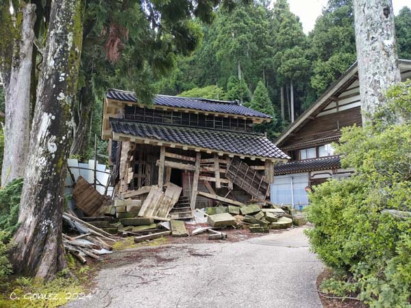
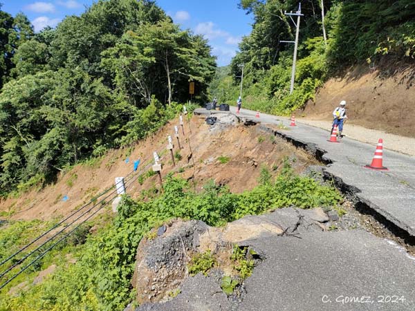
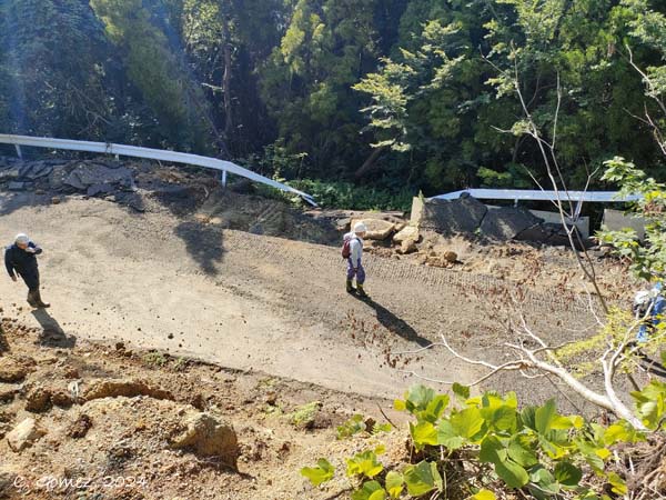
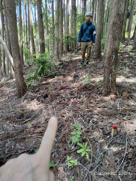
For the present project, we are trying to understand the spatial distribution and magnitude of landslides, as well as how laser-based remote sensing (UAV and airborne LiDAR, as well as SfM-MVS) can be leveraged for assessing infrastructure and building impacts and supporting recovery efforts. Results on these points have already been published between 2024 and 2026 (see list at the bottom of the page).
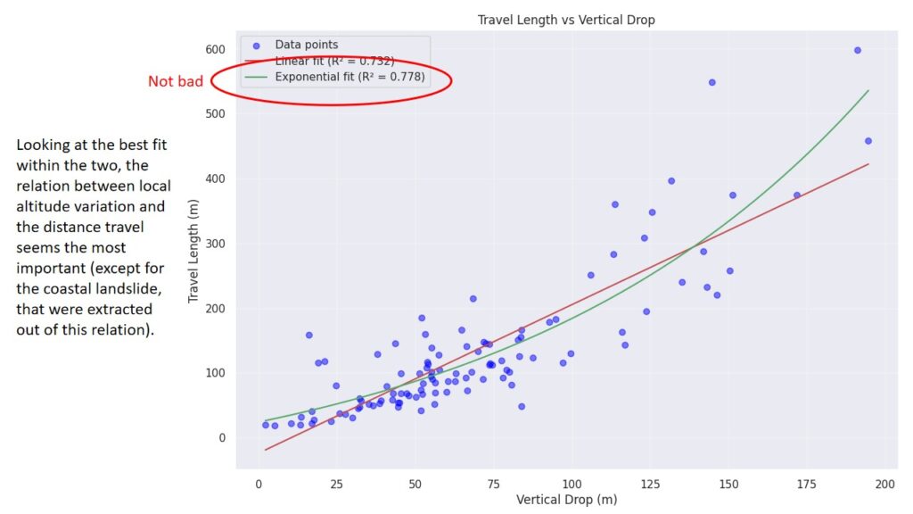
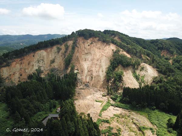
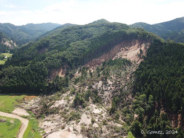
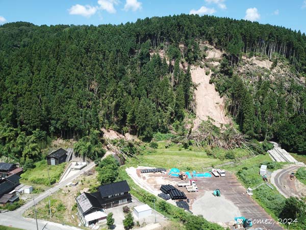
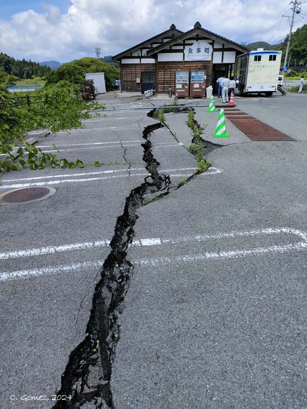
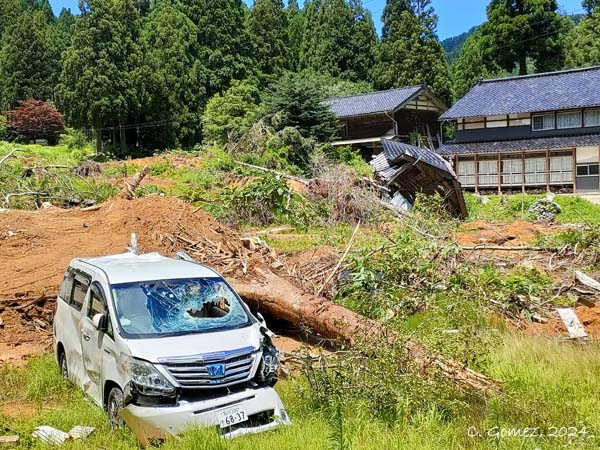
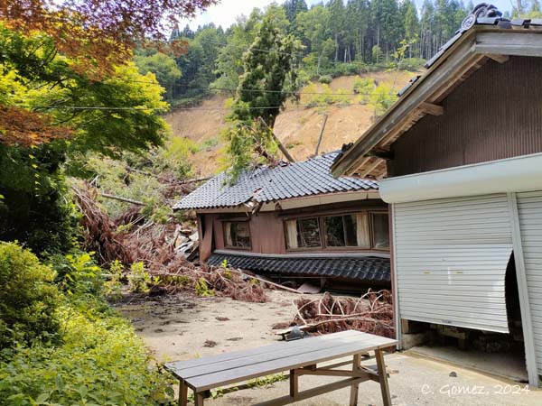
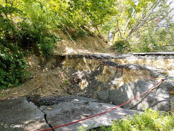
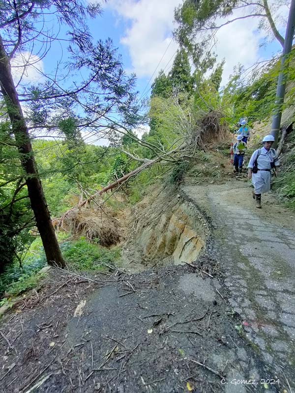
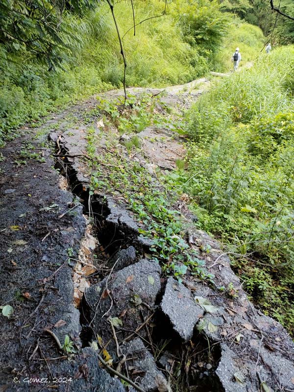
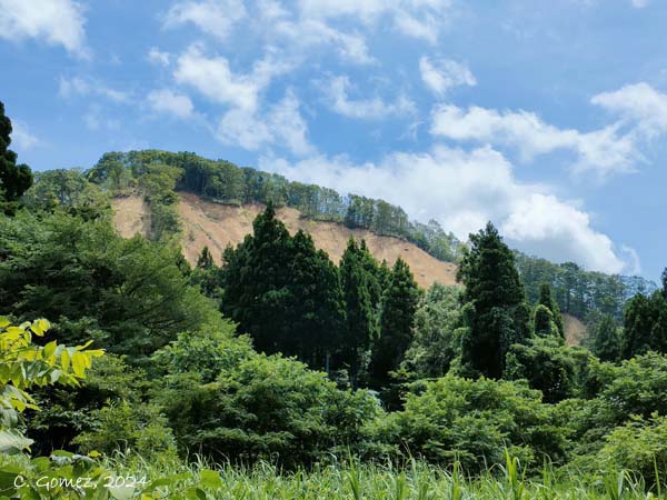
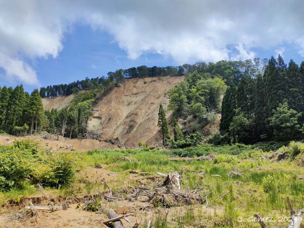
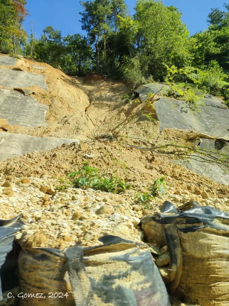
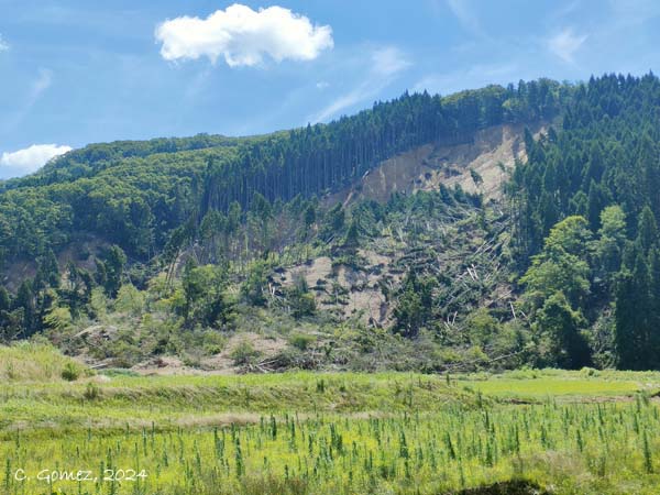
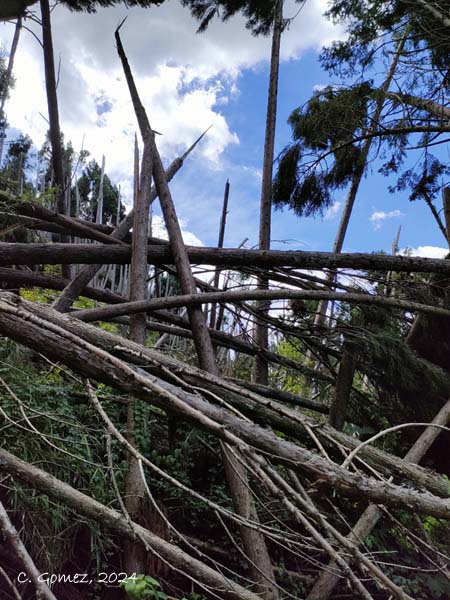
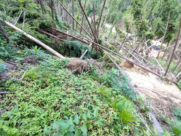
The landslides in the mountains show a length related to the slope length, i.e. the balance earthquake acceleration + material were sufficient to only lead the landslides to a stop when the slope was not “sufficient” to allow movement.

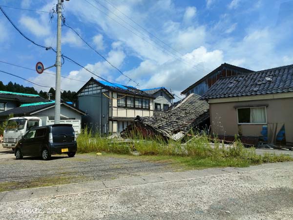
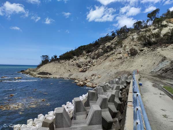
Landslides are thus concentrated along the coastal road because of cliffs and abrupt topographic changes, along river valleys, at localized height (increased seismic shaking effect) and in a formation crossed by a suspected burried active fault.
PROJECT PUBLICATIONS
- Gomez, C. Airborne Lidar for Post-Disaster Recovery in Japan – Lessons from coseismic landslides and lifeline impacts in the aftermath of the January 1st 2024 Noto Peninsula Earthquake. British Geological Survey & American Geophysical Union Geohorizon.
- Gomez, C. Gonda, Y., Tsutsumi, D., Hotta, N., Hori, D., Koi, T., Bradak, B., Daikai, R., Zhang, M., Huazhu, Z., Caihong, L. 2025. Fugeshi River flooding: the effects of the 2024 Noto Peninsula earthquake and climate change. Journal of Disaster Science and Management.
- Gomez, C., Hadmoko, D.S., 2025. Application of LiDAR Differentiation of a Modified Savage-Hutter Model to Analyze Co-Seismic Landslides: A Case Study of the 2024 Noto Earthquake, Japan. Geosciences.
- Gomez, C. 2024. The 1 January 2024 Noto Peninsula co-seismic landslides hazards: Preliminary Results. AUC Geographica