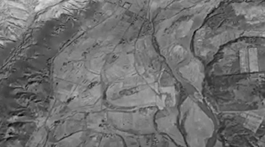
3DHokkaidoPoint CloudSfM1944年、北海道沙流川の流域仮想現実 kaikikazanbear6 months ago01 mins SfM-MVSの写真測量技術を利用して,過去の氾濫原地形を作成が出来る。20世紀の自然現象のシミュレションと土地被覆の研究にもつながる。 Post navigation Previous: Teshima-san (4th year) and Sawada-san (D1) went to collect data in Hokkaido (Iburi and Usu Volcano) for their researchNext: 点群データで作戦された森林内の花崗岩ガリー
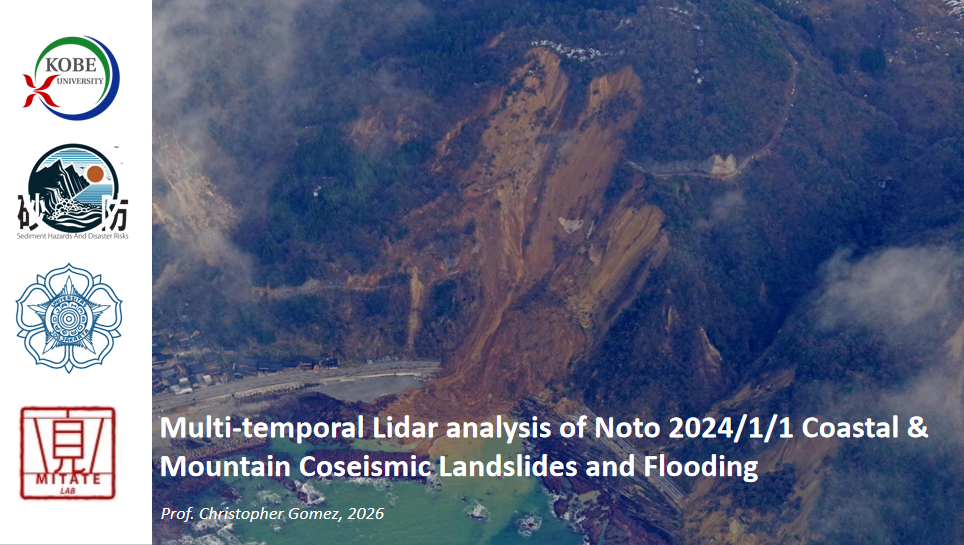
新英論文: C. Gomez. 2026. Airborne Lidar for Post-Disaster Recovery in Japan – Lessons from coseismic landslides and lifeline impacts in the aftermath of the January 1st 2024 Noto Peninsula Earthquake. British Geological Survey Geohorizons kaikikazanbear1 month ago1 month ago 0

")


")